It looks like a simplified map showing the length and breadth of the Shuriman Empire, possibly during its pinnacle. Here are my thoughts:
The structure on the northernmost point of the map is reminiscent of the Sun Disc ward we can purchase, which could be the symbolic representation of a Shuriman outpost or fortress. To the east there are no mountains, while to the west, there are. To the southwest is something that has either been scratched out or the cartographer thought that a bunch of lines sufficiently conveyed the message that no one should go here. Finally to the south we have a massive mountain. All in all, quite fascinating.
Now, here is where things could be interesting.
http://img4.wikia.nocookie.net/__cb20100821100304/leagueoflegends/images/c/cd/MapofValoran.jpg
Take a good look at the old map of Valoran. Now flip it.
Those flat lines southwest of Shurima on this map seems to match Tempest Flats northeast of it on the old map fairly well.
West of Shurima seems to be a lot of hills, or potential indicators of hazardous terrain, of which I am sure the Voodoo Lands must have. More importantly, there is some sort of structure ringed behind some mountains with a strange aura, and east of Shurima on the old map, which is west here, is Bandle City protected by the Sablestone Mountains.
North of Shurima here is that possible outpost, suggesting the northern border must be protected. South of Shurima on the old map is Kumungu and the Plague Jungles, mostly unknown territories with undoubtably vicious creatures that call them home, such as the man-eating flower, no pun intended, Zyra originally came from, and the poisonous mushrooms Teemo collects. Seems like a place worth keeping my eyes on.
Now to the east of Shurima here is... something; the map's right half is the most damaged. However, roads from Shurima's capital most definitely lead in this direction, and correlating with this on the old map is Uristan. It is possible that during the height of Shurima's empire, Uristan was still intact, prompting trade between the two nations.
Finally, we have the south, where an impressive mountain rises above all others. Now on the old map, north of Shurima is the Great Barrier, and crowning it is Mount Gargantuan, later to be retconned as Mount Targon.
In short, either Ancient Shurimans thought north was south and vice versa, or we may be looking at a retcon of Valoran's cardinal directions.


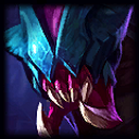 is depicted fighting
  on a wall; at *least * it might have 1000 years ago. It is described to be in southern Shurima, wherever that is. The south-west part might be just that. That would clash with the theory of the map being flipped, though. Although I doubt it, maybe Shurima is north of Mount Targon and the rest of the Great Barrier now?