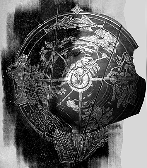
Valoran map

Hello I was wondering if you guys think the map of valoran could be fleshed out more? The only map we have now is a cluster fuck of cities and no room for space. Anyone wanna provide how things should be spaced, placed, and why?
Hello I was wondering if you guys think the map of valoran could be fleshed out more? The only map we have now is a cluster fuck of cities and no room for space. Anyone wanna provide how things should be spaced, placed, and why?
Right now we actually only have three canon maps: Freljord, Bilgewater/Shadow Isles and Shurima, and only the Freljord one is strictly geographical, the other two have a bit of creative license with them.
This is Freljord: http://img4.wikia.nocookie.net/__cb20140223094402/leagueoflegends/images/2/24/Freljord_Map.png
This is Shurima: http://img2.wikia.nocookie.net/__cb20150227214027/leagueoflegends/images/2/2e/Shurima_map.jpg
And this is Bilgewater/Shadow Isles: http://img4.wikia.nocookie.net/__cb20141106011552/leagueoflegends/images/2/2d/Black_Mist_Map.jpg
As an added extra, this is a closer shot of the Shadow Isles, specifically its centre: http://img1.wikia.nocookie.net/__cb20121017224252/leagueoflegends/images/f/fd/Shadow_isles_concept.jpg
So while only the Freljord map is completely accurate, the others are still helpful. What we can garner is as follows:
Not sure if this was really helpful or anything, but I hope it gave some idea to what geography is like in some areas of Valoran.
EDIT: As an added note to clear something up: while Valoran's shape has changed, most of its regions are still in the same place as far as we know. The Shadow Isles is the only thing that moved to the best of my knowledge. As a result I'd say it's safe to assume that Everything is in the same relative location as it was in the old map, but there are some distinct geographical differences.
Also to answer your initial question, yes. More updates maps please!
I think the old map of Valoran was pretty generic and underwhelming. With the expansion of lore (um...) the map could be expanded on as well. We've got some tidbits of maps with the lore retcons of the Freljord and Shurima, and the most recent Harrowing gave one too.
I think it would be cool if there were more than just the one continent and a couple islands. Maybe two major continents? There's also a few areas on the old map that aren't touched on at all.
Now, with the info given to us and the very old map we had, this is the new depiction of Valoran with all key places as a source of reference. Keep in mind Shadow Isles is bellow Blue Flame Islands, so its not placed where it should be, but the overal size of it is in par with what it was in the old map.
Shurimas map is symbolic, which means take its info with a grain of salt because it doesnt show accurate locations of all the locations its pointing out. Freljord one is weird, its ether smaller in comparison to the old map, or its way up north doing its own thing and just being connected with the mainland by the bottom half. Quinns has a lot of inconsistencies with the size of the city and the size of the river. But overall, with the best of my abilities, this is how Valoran should look like.
Also we have a map outside of Demacias Capital, its showing us two mountain ranges between the Serpentine river. It also mentions a Golden Crossing, probably a bridge or a small opening between the mountain cliffs.
Very insightful guys, I ask cause we will be trying to make a rpg game of Lol and we need to know of maybe the reds or people would like a more fleshed out version of it