Worldbuilding: Geography of Runeterra (and more!) (MEGAPOST!!)

Of course we don't have a full map of Runeterra - if the most believable fan map I've seen has anything to say, the Medarda Heirloom is just a tiny square of the world as we know it. But we at least know most of what direction everything is in, so I'll work off that. Here we go! I would absolutely love it if a Rioter could tell me how correct - or incorrect - I am on many of these points!
Demacia: Southwestern quarter (or strip?) of the northern continent, with territory on the north coast of the unnamed strait between Valoran and Shurima (and more). (The western edge of the Medarda Heirloom features an ostensibly Demacian city where no Noxians are permitted ashore.) A mix of plains, rolling hills, and mountains, with much of the land that has not been cleared for agriculture/building covered in deciduous forest or lush grasses. Drier with more extreme temperatures toward the interior, and snow on the mountains/in the northern parts of Demacia. West coast of Demacia (if there is not another nation on the coast of the continent instead) is a marine west coast climate, cool and rainy. Note that much of the rock in Demacia is petricite. Cities and villages look somewhat medieval, but there is a lot of open space compared to a Noxian fort for instance. Architecture is palatial, open, and airy, with a lot of circles and arches and a hell of a lot of petricite.
Noxus: Located to the east of Demacia. I imagine Noxus has a Mediterranean climate or similar - it's definitely arid, so my home state of California sounds like a good comparison given the damn drought! Mostly mountainous with stretches of habitable foothills and some plateaus, Noxus's lack of natural resources has made them as warlike as they are. Cities, towns, and forts are built for utility rather than navigability, with winding narrow streets - very medieval western European. Architecture is imposing but very functional, and looks hostile - darker stone or wood, very squarish, etc.
Ionia: A mixture of terrain that is influenced heavily by the native magic of the island chain - many land forms appear downright magical (lots of amazing rock formations), though the parts of it that aren't as magically influenced are still very diverse: hills and mountains, grasslands, jungles, even a desert. Climate is very varied, think Japan, but I imagine the cooler mountain territory is toward the north end of the island chain, the warm grasslands and perhaps the Ghetu Desert are further south, and the sweltering jungles lie at the southern tip (which is likely in the tropics). I'd imagine the architecture of an Ionian village looks more elven than East Asian due to the fact that it's mostly made of living trees.
Shurima: Occupies at least a great portion of the southern continent. It's not all sand dunes! Rather than look at the real world, I look at Elona from the Guild Wars universe as an inspiration for Shurima: while there is still lots of sand, it still has a huge amount of terrain variance, with mountains, fertile rivers, and coastline. Different parts of the desert may have different types of sand or feature more outcroppings or rock formations. Climate is as arid as you'd imagine, though it can get pretty cold at night further inland, and it's more temperate in any mountain ranges that may exist. Seasonal rains flood rivers around Shurima, and presumably the population is very dependent on these to grow crops. The northeast coast of Shurima, closest to Noxus, probably has something more like a Mediterranean climate (like Noxus), or at the very least a wet and dry season.
Freljord: Located to the northwest of Demacia, most likely, if we assume the arrow pointing to it on the Heirloom is a sea route. It's not all snow and ice! Think of Scandinavia: mountains (probably mostly mountains in this case), fjords, glacial lakes, southern lowlands, and then actual tundra to the far north. There is some volcanic activity, for instance in Ornn's mountain forge; this is not something we see anywhere else, to my knowledge, unless there are any volcanoes in Ionia etc. (EDIT: there's one further south, where Shyvana was born.) Climate varies depending on latitude, provided it isn't magically affected or Runeterra doesn't use the half-arsed excuse of "it's not Earth." Ashe and the Avarosans probably live in the cool/temperate south, Sejuani and the Winter's Claw in the colder mountains and tundra, and Lissandra and her Frostguard to the far, far north, where everything really is snow and ice. Architecture varies, but is usually somewhere between gothic and Nordic (or fantasy-Nordic).
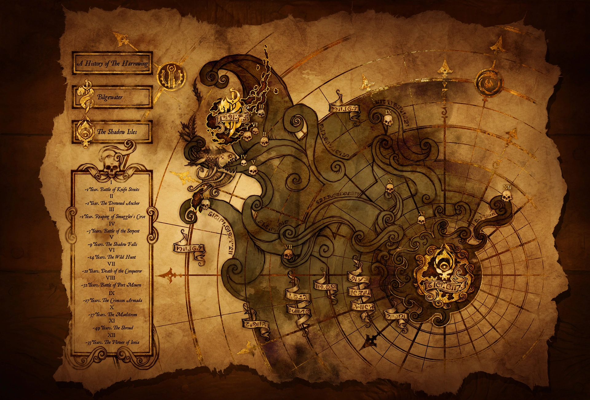
Bilgewater and the Serpent Isles: Bilgewater is just part of the island chain called either the Serpent Isles or Blue Flame Isles, depending on who you ask. It's the most desolate of the islands, hence the use of ships as building material and the need to ship in food from elsewhere. Because... it is literally all rock. But that's not true for the rest of Buhru territory: the other islands are more like parts of Kaua'i (I've been there but I feel like there's a better comparison). Rocky, not a lot of room for crops, but very fertile and tropical in climate and biosphere. (Seafood, fruit, nuts, seeds, and root vegetables are presumably most of the constituents of the Buhru diet.) Also I guess it has some nice gold veins because Buhru temples are gold-plated. Climate varies: tropical heat is balanced by the cooling ocean, which may or may not lead to frequent storms at sea. We don't know much of anything about Buhru architecture but if we do see it, I won't be surprised if it has a lot of Aztec influence.
Piltover-Zaun: Just east of Noxian territory, so shares its (maybe) Mediterranean climate. Somewhere between Victorian and Italian architecture in Piltover, steampunk-Victorian in Zaun. Not much geography to speak of considering the city's small horizontal area - it's basically built around a giant ravine on the coast.
Mount Targon: No headcanons for this one. Any geographical info about the area is already established. Along with its major magical influence on the terrain, and it being a pretty small area, we have no clue where in Runeterra it is, though most educated guesses I've seen place it in northwestern Shurima.
Void: The actual Void is probably something of an is-not, but the caves below Shurima where the border between worlds grows thin (which are also where Kai'Sa spent half her life) look a lot like the Dragonbrand in Guild Wars 2. Except more organic than crystalline. That is basically all I can provide.
Shadow Isles: EDIT: The one resource I have is that it's southeast of Bilgewater, which means it's positioned kinda like New Zealand. (Thanks comment section!) So back when it was the Blessed Isles, it was probably nice and temperate with fertile fields and forests, kind of like the hemispherical opposite of Demacia.




 and
and  biographies serve of any indicator, they would had vast forests and fertile crops.